Trip Details
Date: May 19
th, 2017
Total Distance: 12.23 mi (via Trimble Outdoors Navigator Pro on iPhone 4S. I forgot to turn it on until we were about a tenth of a mile up the trail at the start.)
Total Time: 5 hours 7 minutes
Total Elevation: 2722 ft gained
Click for more details.
Well it just will not stop snowing in the White Mountains, so to start the season BishopX, Boomer, and myself ventured over to the Belknap Range and more specifically, Mt. Major and the summits to its west. We wanted to get some mileage so we made a large loop out of it. Hiking outside of the White Mountains really makes you miss the
White Mountain Guide Online. That tool makes planning simplistic and takes a lot of unknowns out of the equation immediately. For the Belknap Range I had a copy of the
maps from that I ordered from one of the listed libraries a few years back. They had since re-blazed many of the trails. It is a nice map, but the trying to determine mileage takes a lot more effort. We were thinking the trip would come out to around 10 miles...
The weather was in the high 70s, but it was humid and the wind would at times just completely die. When that happened, the black flies would just start swarming. This made for a long day. Plus, we did not start early enough so we ended up in a race with about a hundred middle school children on Mt. Major. We caught up with the tail end of their group, but it made the picturesque summit of Mt. Major harder to enjoy. Regardless, the summit still had great views even if it was overcrowded and a bit hazy in the far distance (no views of the still snow covered Mt. Washington today).
 |
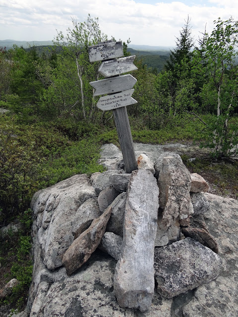
| The signage on all these trails could use some standardization. |
 |
| Looking up the infamous granite slabs. |
 |
| Looking down the infamous granite slabs. |
 |
| The view across Lake Winnipesaukee. Those are the Ossipee Mountains in the distance. |
 |
| Boomer enjoying a mud puddle. |
 |
| The stone foundation on the summit of Mt. Major. |
After that we left the crowd and dropped off the backside of the summit. We started our way to North Straightback and the Quarry Mountains.
|
|
|
| Do not question the white arrow! Follow the white arrow! Okay, seriously turn left at the white arrow. |
The trails felt more like walking through the woods with a bit of roller coaster up-and-down. Since the overall elevation was not that high it never felt like there was that much of a change. There were a few ledge spots that I had to help Boomer on, but all the sections were small. We blew over North Straightback without even blinking an eye. We stopped on East Quarry for a quick photo.
 |
| Boomer is wondering what in Sam Hell is BishopX doing on East Quarry Mt. The summit is not labeled and not real obvious. We assumed it was this high point. |
The trip over to West Quarry was more of the same.
 |
| West Quarry Mt. summit. |
 |
| An outlook just past the summit. |
Another section of ledges follows and then you make your way into the old quarry.
 |
| Click to blow-up and read. |
 |
| Old rusted junk. |
We then climbed out of the quarry and made our way over to Mt. Rand.
 |
| Mt. Rand summit |
 |
| An outlook just past the summit. These were few and far between on this loop. |
The next summit would put us on our northwestern terminus of the loop. We were almost at the half-way point which was good as it was nearing lunch time and the heat and lack of wind were starting to get rough. Not to mention the insistent black flies and ticks I was having to pull off myself.
 |
| This rock indicates the direction of the spur trail to the summit. |
 |
| Mt. Klem summit. |
We joined back up with the Belknap Range Trail, which is labeled better but still requires you to follow multiple different colored trails. We found some open granite slabs on our way to Mt. Mack and ate lunch. There was some on and off wind that helped keep the black flies at bay for the most part. After lunch we continued on to the summit, which had an interesting surprise on it.
 |
| The Belknap Range Trail is red at this point. |
 |
| BishopX sleepwalking on the Mt. Mack summit. |
 |
| Communication tower on the Mt. Mack summit. |
As we just started back in the direction towards Mt. Major the day was getting long and fatigue was setting in. The biggest elevation change during this whole hike is between Mt. Mack and Mt. Anna where you lose approximately 600 feet of elevation. Thankfully, it is a gradual climb back up.
 |
| Mt. Anna summit |
Pay close attention on your way to South Straightback as in the col between the two peaks there is a fork in the trail that is not well labeled. If you find yourself in a wet area you are on the wrong trail and are heading back to West Quarry. Turn around and stay on the Belknap Range Trail. South Straightback is an open summit but at this point we were fatigue and ready to get back to the car. I took a summit photo and we booked it out of there. The end was in sight!
 |
| Back to the crazy signage... |
 |
| South Straightback Mt. summit |
It was quite exciting to reach the junction and get back on trail we were familiar with.
We took the Brook Trail around Mt. Major instead of going around the summit. This trail is nice as it is gradual and well graded throughout. Most of it feels like you are on a dirt road. Eventually, we got back to the parking lot and discovered what we figured was a 10 mile loop was actually 12+ miles. Oops...
I now only need two more Belknap Mountains and I will have hiked them all. Rowe and Whiteface I am coming for you!
|
|
The mileage is probably off, but I have nothing to really judge it against. It is missing approximately a tenth of a mile as I forgot to turn on the tracking until we started on the trail. |


No comments:
Post a Comment